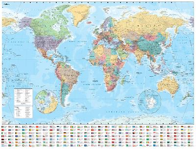
This laminated Collins World Map has been fully updated to include the latest political changes, and contains politically coloured mapping showing each country and their capital city, major roads, railways and cities and towns clearly. Also included are national flags, key statistics for every country and inset maps of the polar regions.
This laminated (on front side only) map is ideal for any classroom, bedroom or office wall.Buy Collins World Wall Laminated Map by Collins Maps from Australia's Online Independent Bookstore, BooksDirect.
 Collins Student Atlas: Ideal for learning at school and at home (Collins School Atlases)
 Collins First Atlas: Ideal for learning at school and at home (Collins School Atlases)
 Collins Primary Atlas: Ideal for learning at school and at home (Collins School Atlases)


 Checking availability...